


Engineering-driven reality capture for reliable above-ground and underground infrastructure intelligence
Industrial transformation, modernization and brownfield expansion all begin with one fundamental requirement: understanding what already exists in the field with sufficient confidence and accuracy. Virtual Plant® creates this foundation by capturing and structuring infrastructure reality through engineering-driven reality capture methodologies tailored to each operational environment.
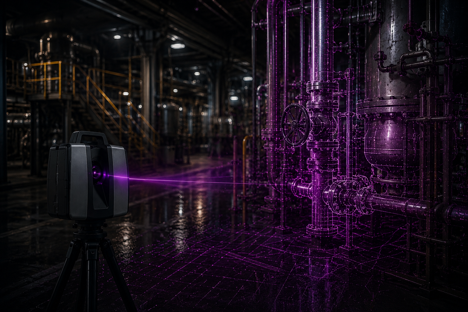
Unlike generic visualization platforms or single-method scanning approaches, Virtual Plant® does not depend on one fixed technology stack. Different industrial environments require different capture strategies depending on the objective, required precision, operational constraints and future engineering expectations. For this reason, Virtual Plant® combines multiple capture technologies and engineering methodologies to build reliable infrastructure intelligence for complex industrial assets.
Depending on the use case, this may include terrestrial laser scanning, mobile scanning, SLAM technologies, drone-based imagery, panoramic imaging, photogrammetry, geospatial surveying and underground detection technologies. The goal is not simply to create a visual model, but to establish a reusable digital infrastructure foundation that can support operational workflows, engineering activities and future transformation initiatives.
In many industrial sectors such as tank terminals, gas infrastructure, chemical plants, utilities and energy facilities, data quality and engineering reliability are critical. Captured information is often expected to support not only visualization purposes, but also engineering validation, maintenance planning, retrofit projects, Management of Change (MoC), asset integrity activities, future back-modelling requirements and brownfield modifications. This requires an engineering-grade understanding of accuracy, tolerances, asset relationships and operational context.
Virtual Plant® therefore approaches reality capture as an infrastructure intelligence process rather than a standalone scanning activity. Engineering expertise, field validation and operational understanding are integrated directly into the capture workflow to ensure that the resulting environment can be reliably used across multiple business and engineering functions.
Above-Ground Infrastructure Intelligence
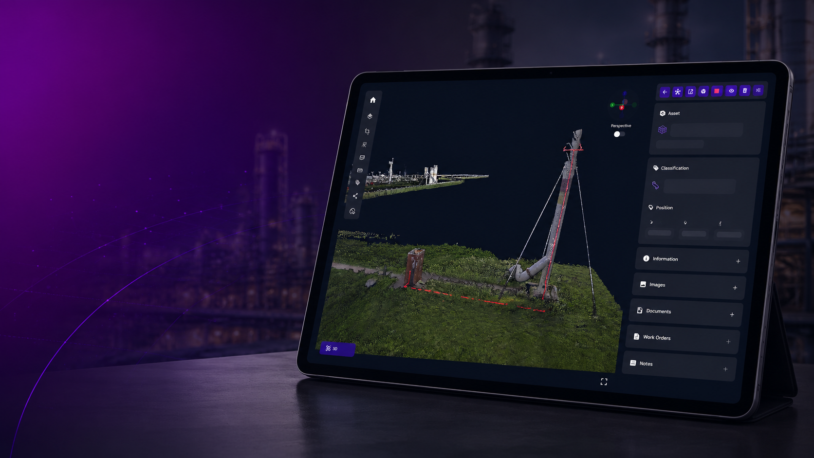
Virtual Plant® captures and contextualizes above-ground industrial infrastructure including piping systems, process equipment, tanks, buildings, cable routes, structures and operational environments. The platform enables organizations to navigate and understand existing facilities with the level of detail required for industrial decision-making and engineering-driven workflows.
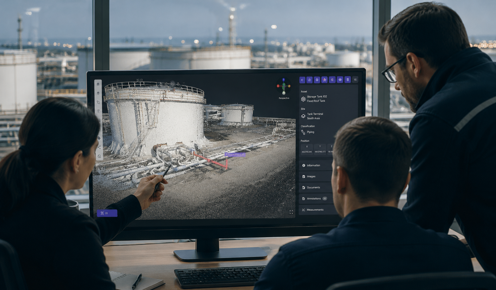
Captured environments can support:
- Brownfield project preparation
- Engineering validation
- Asset documentation alignment
- Maintenance and inspection planning
- Shutdown and turnaround activities
- Future engineering and back-modelling initiatives
- Operational collaboration across distributed teams
Rather than creating isolated datasets for individual projects, Virtual Plant® establishes a scalable infrastructure intelligence layer that can continue evolving with the facility over time.
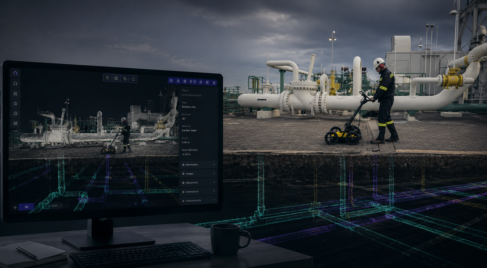
Underground Infrastructure Intelligence
Underground infrastructure remains one of the largest visibility gaps in industrial environments. Buried pipelines, cable routes, utilities and hidden infrastructure are frequently undocumented, outdated or difficult to validate, creating significant risks during excavation, retrofit and expansion projects.
Virtual Plant® addresses this challenge by combining Ground Penetrating Radar (GPR), geospatial surveys and engineering intelligence to identify, interpret and structure underground infrastructure information. Unlike standalone utility detection approaches, the detected underground environment is processed through engineering workflows and integrated into the broader infrastructure context.
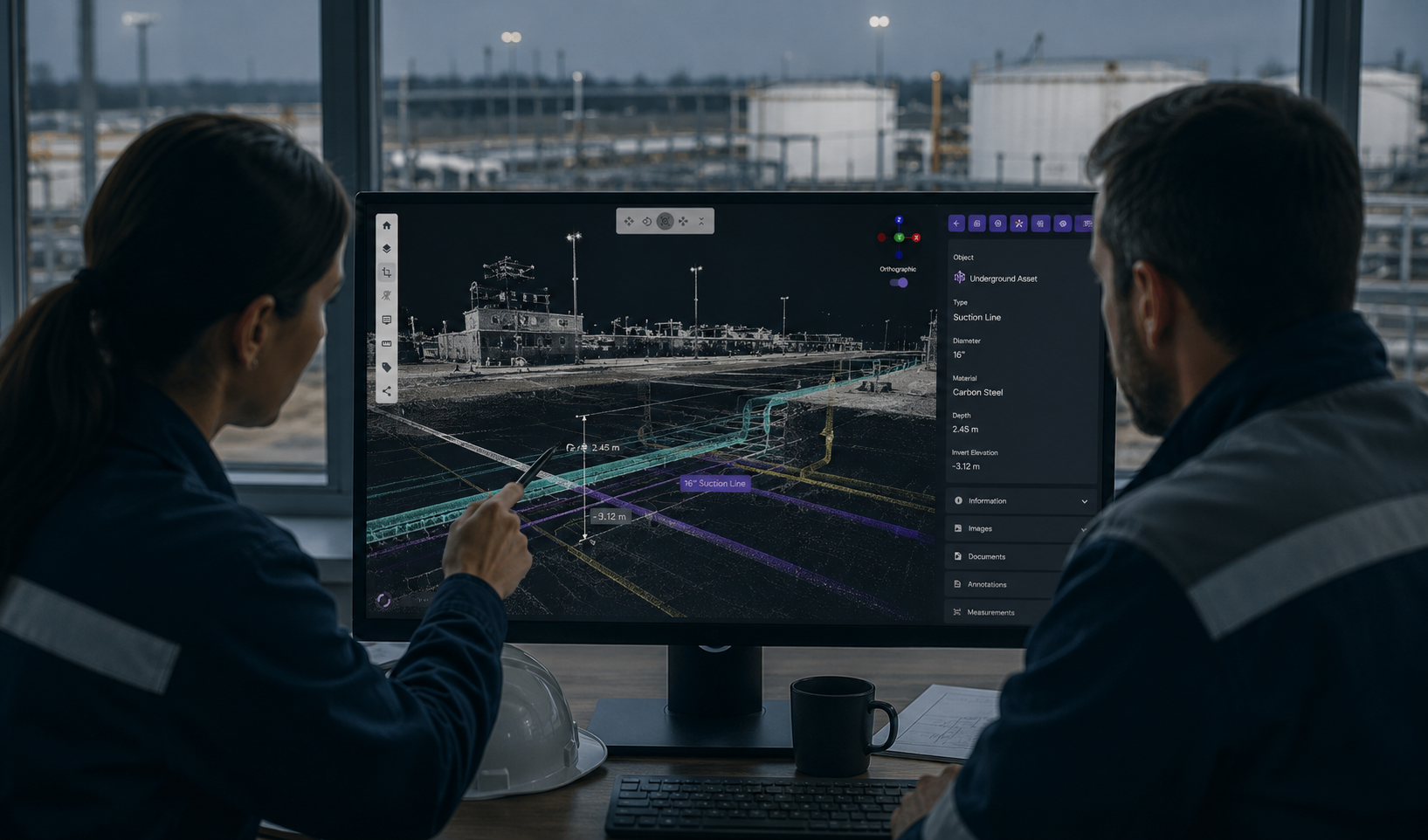
Engineering interpretation is especially critical in complex industrial sites where underground information must later support brownfield engineering, safety planning, integrity management and future construction activities. Underground infrastructure can be visualized using engineering-grade 3D CAD techniques and spatial modeling approaches, then integrated directly into the Virtual Plant® environment alongside above-ground reality capture and point cloud data.
This creates a connected above-ground and underground infrastructure intelligence environment that improves project confidence, reduces uncertainty and supports safer decision-making for existing industrial assets.